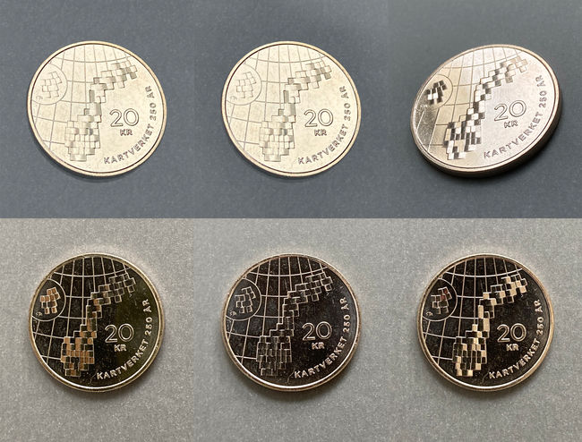
Topographical Twin (20 kr coin - 2023)
The commemorative coin celebrates the 250 year jubilee of The Norwegian Mapping Authority (Kartverket). The image I designed has two layers that attempt to unite historical and present activities. The first is the "pixelled", but easily recognizable outline of Norway. It points to the Norwegian Mapping Authority's historical task of measuring the country and creating map series. The grid is based on the index map of the last of the main series of Norway, M711 (1: 50 000), where the original number of 727 map sheets have been simplified to 72.
A text is hidden within the map series - a location-oriented and digitized duplication of the normal, legible writing along the edge of the coin. To understand the hidden text, the reader needs to be able to interpret the "landscape". The coded language points to The Norwegian Mapping Authority increased occupation with interpreting and managing complex and underlying geodata.
Of course, a coin is a small object, and each rectangular map sheet only covers ca. one square mm. But the facets reflect light almost like a mirror ball, and the key to the text is the direction they are tilted. With knowledge of the (so-called) binary number system, it's manageable to decode it. Anyway, the tilted facets also exploits a coins potential to use relief to create something that sparkles and is lively.


